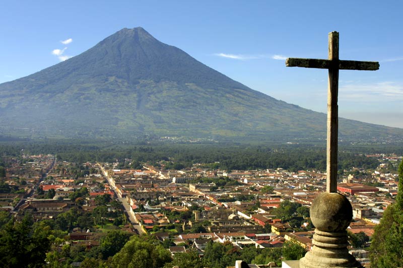
Antigua (shown sitting beneath the Water Volcano) is located in the southern-central region of the country on the Pacific Ocean facing side. Antigua’s climate is tropical, humid, and consists of a wet (July through August) and a dry season (November through April). It’s climate, and soil, is ideal for agriculture which consists of its large number of coffee and fruit plantations.
The overall physical geography of Antigua, Guatemala is comprised of a volcanic mountain range in a Tropical Climate Zone. This volcanic mountain range is a result of subduction of the North American Plate and the Caribbean Plate. These volcanoes date back to over 200,000 years, and run from the north to the south perpendicular to the Central American Volcanic Arc. These stratovolcanoes are responsible for some of the region's largest recorded eruptions, earthquakes, and debris avalanche. All events which have the potential to greatly influenced the geography, climate, and chances of sustaining human life.
I hypothesis that 10,000 years from now Antigua will be buried from an eruption event, a mass wasting event, or another severe earthquake event. Any of those single three event could trigger the others, and history has shown that devastating things can happen to human developments placed too close to mountainous areas where seismic and volcanic activities are prevalent. For example, the former ancestral Acatenango volcano collapsed and formed the La Democracia debris avalanche deposit (shown below as the outlined grey area). This stretches over 50 km and covers more than 300 km2, and a future disaster of a similar magnitude could endanger more than 100,000 people.

I hypothesis that 1,000,000 years from now Antigua will be a fluvial landscape. This could be a result of either Liquefaction due to seismic activity weakening the ground and causing it to sink over time, or land subsidence if the water table is depleted from excessive discharge. For example, in San Joaquin Valley, California (shown below) where the ground sank over eight meters in just fifty years. As Antigua sinks, and assuming sea levels continue to rise, the mountain range would become a drainage basin. The increasing water will physically and chemically alter the mountains over the next millions of years.

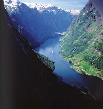
I hypothesis that 10,000,000 years from now Antigua will be undergo the glacial process. If the earth undergoes another ice age, the weathered mountain range is ideal for snow & ice accumulation. The volcanos symmetrical profile and composite construction would undergo further stress as the freeze-thaw cycles expands the glaciers and erodes them, ultimately forming fjords after melting (such as Iceland shown below).
As the Antigua region continues to develop, thoughtful land management and natural disaster preparedness will be essential in allowing humans to continue living so close to these great extrusive-composite volcanoes. Without understanding its past, and speculating on it’s future, Antigua and its people will be at a great disadvantage to nature and the physical and chemical processes which gave us the powerful landscapes we still coexist beside today.
No comments:
Post a Comment